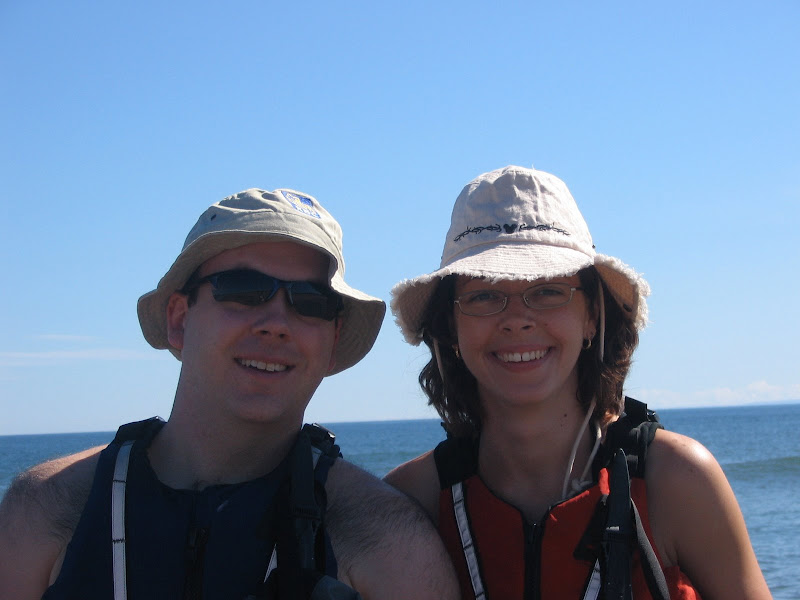
Our first camping trip of the year took us to the beautiful Achray campground in Algonquin Provincial Park. We had to book this trip the full 4 months in advance to ensure we got a good waterside campsite that had launch access for our boats. Even booking 4 months in advance there were several people who had reserved campsites already! They were too funny.
Day 1:
The trip started with a severe thunderstorm warning for eastern Ontario including Algonquin Park. On the drive up we didn't notice many clouds and the skies looked clear so we kept our fingers crossed. Even if big winds came up we had so much stuff in our car that we wouldn't have blown away regardless.
When we arrived at the Sand Lake gate to the park there was a large sign on the door warning of the impending thunderstorm but the person working the gate thought it might pass us by. Boy was she wrong! We arrived at our campsite at about 2:30 and barely had time to unpack the car much less set up the tent before thunder and rain started. We hurried so fast to put up our tent we put the bungee poles on sideways. Somehow the tent managed to survive though.
We were offered a brief respite of calm weather (about 15 minutes) before the main storm hit. Then it was almost 2 hours straight of thunder and lightning with torrential rains. Shanna was terrified as she despises lightning! There was a tornado watch as well and some of the thunder lasted so long it sounded like a freight train coming and that made em think of a tornado. Luckily, we made it through with nothing but our pride hurt and our campsite relatively intact.
After the thunderstorm it was almost dark. We attempted a swim but the air and water temperatures were too chilly to do anything other than briefly dunk.
Our campsite was gorgeous, big rocks on one side of us, forest on the other and very private compared to the other campsites. We were also very close to the privy with flush toilets! A big bonus. Our waterfront was mostly flat rock and fairly shallow out for about 20 feet and then a huge drop off. Most of the lake was like this in fact, rock to about 10 feet offshore then a straight drop into nothingness. It took some imagination to find a launch point for our boats off of this rock shelf but we managed to find one.
Being waterside was especially amazing on this large lake. The lapping water on the rocks and the loon calls on the water lulled you to sleep at night.
From almost the first moment we got out of the car we noticed how tame the local chipmunk population was. They appear to be of the Eastern variety and many of them suffering fomr what appeared to be the mange. One in particular, who we named mangy-tail, was so tame he came right up and took nuts an seeds right out of our hand. He would even stand up and give me a disappointed look if I had none on me for him! There were a couple of other chipmunks who we called fluffy-tail and mangy (since most of his fur was gone, poor thing). Mangy-tail would often put the run to these other two if they got too close to us.
Day 2:
We weighed our options for adventure on this our only full day. The weather was calling for 22 and sunny, no humidity so we decided to go on a long kayak trip. The lake that Achray is on is called Grand Lake and it is quite Grand! It's long and somewhat narrow (compared to its length) and the Adventure Map we have of the area lists several log chutes, rapids, waterfalls, old logging camps, etc. that are interesting. We decided to explore the lake heading south towards some aboriginal paintings and a set of waterfalls.
Of course, any trip of ours cannot go off without a hitch ... the hitch this time was that Shanna's camera decided to malfunction so we couldn't get any pictures from it for the weekend. Only later did we resort to using her new camera-phone.
The wind was calm and the sun a perfect 20 or 22 for most of the trip. Paddling was very easy. We travelled first past the aboriginal paintings which were very, very faint and in a location that might have once been an excellent diving platform because of the well placed ledges on the rock. We passed a small island inhabited by a colony of seagulls and another larger island that was in a tighter part of the lake that led into a small bay. There were a lot of deadheads which are evidence of the logging drives that were once popular in this area for getting the winter cut out of the woods.
We came upon a small but powerful rapid that required a short portage. Unfortunately this portage is only good for canoers, not kayakers. Luckily we found a spot to scramble out and climbed around the portage to glimpse the falls we heard in the distance. These falls, called High Falls, were simply amazing. Not very tall but powerful, especially for this time of the year and it was so peaceful. There was no one else around for a few kilometers at least. Would have been a nice place to lunch. It was here we saw our first snake, a common garter snake that was about 2 feet long. Shanna spotted him slithering across our path.
We went back to our boats and decided to paddle for an abandoned logging camp at the opposite end of the lake (falls were in the South East corner, camp in the North West). We paddled by the sea gull colony a bit too close, at least three gulls took a purposeful run at us with one of them trying to divebomb us with poop. The other gulls raised quite a ruckus. They were protecting their young which appeared to be black-feathered and fluffy.
We stopped for lunch in a small cove and ate while rafted up in our boats. There are literally thousands of tadpoles in the lake this time of year and many of them watched us eat our lunches while floating lazily on the bottom.
After we ate lunch we saw a couple of common loons fishing (maybe for the tadpoles!). You could always hear the loons on the lake with their distinct call. On our way back form the logging camp we had a loon pop up not 20 feet from us and curiously float around us before diving back into the water. Curious behavior as they are often shy in our experience.
The geography of the lake was very interesting. First off the lake was covered in a thin layer of pollen that caused havoc for my allergies. It even turned the shallow water a bit yellow. The second interesting feature was the rock. There was a lot of exposed granite and gneiss on the shore. Most of the rock was worn smooth, presumably from the ice age when glaciers and huge rivers were present in this region. In the lake itself though there was rarely a shallow spot and very few places a person in a kayak or even a canoe could get out. Mostly the shore just dropped into the bottom of the lake. These lakes are very cold at the bottom and we saw a lot of people on the water fishing brook and lake trout.
We paddled most of the afternoon and took in a lot of the scenery but the sun and effort was wearing us down and we had to turn around before making it to the abandoned logging camp. Shanna had a bad sunburn on her arms from her sunscreen wearing off and we were both pooped.
It turns out we were on the water for over 5 hours and paddled around 16km.
That evening we had an awesome dinner of lemon chicken and potatoes that Shanna had pre-prepared. for dessert we had some banana boats. yum!
Day 3:
Our final day at the campsite. We got up early, made breakfast over the fire and packed up. We almost stepped on a large snake that definitely was not a garter snake. This one was rounder and longer and was dark colored (almost black) with light red vertical striping. We would love to identify this species. He slithered off in the rocks close to the water.
After packing up the campsite and leaving an ample supply of trail mix nuts for ol' mangy-tail we headed for the Barron Canyon Trail. This is a very short trail, about 1.5km, but it involves a steep climb. The big draw of this trail is that it overlooks Barron Canyon from its highest points ... some 100m above the Barron River. The views from up here are absolutely breathtaking. Exercise extreme caution though, you can go right up to the edge of the cliff and look down but there are no rails or other safety systems. In 2004, a hiker apparently died after falling from this cliff. There are some cool trail guides at the bottom of the trail for about $0.50 and are worth it. The guide explains how the canyon was formed and gives its history both geological and anthropological.
Summary:
Achray was simply amazing. The well-organized and small campsite is beautifully maintained and there is so much to do around the area. Next time we go we're going up on a Thursday night to spend two full days doing activities. Even then you couldn't possibly do everything.
Sunday, June 10, 2007
Tuesday, May 8, 2007
Kayak 2007-1 : Shirley's Bay
It was a beautiful spring day on Sunday with perfect conditions for a paddle. The sun was shining and there was hardly a cloud in the sky. The UV index was reasonable and the air temperature was around 16, even the water temperature was merely chilly, not frigid.
Shirley's Bay is on the Ottawa River and is a part of the NCC Park system. There is an excellent launching point for both powerboats and kayaks/canoes there. The park itself is quite nice with some walking trails nearby and a beautiful view of the River and Gatineau in the distance.
We have paddled this stretch once before, last year, and knew the route so it wasn't a trip to discover the wilderness, we just wanted to stretch our paddling muscles some!
We headed west along the Ontario bank of the river. There is a rifle range on the Ontario side (the road to the launch point is called Rifle Road) so you can hear random gunshots going off.
After you paddle for about 30 minutes you will come along a little island. Normally this is a great spot to pull up on the beach and have lunch as the island is small, surrounded by beach with real sand and right in the middle of the river. On this occasion though the water level was really high so there wasn't much beach, and what beach was there was covered by seagulls! Dozens of them. So we kept on paddling.
The only other event was coming across the set of buoys marking off the DND water. These were bright yellow, scattered everywhere and marked with big Danger! signs. Suffice it to say we left it at that.
So that was the first paddle of the season, not too exciting but a good stretch.
Sunday, March 11, 2007
A new GPS unit
After a couple of years of using my original Garmin eTrex Legend I finally decided to upgrade. After looking at the various models I decided on the top-of-the-line Garmin model, the GPSMap 76CSx.
My eTrex Legend had a lot of limitations. First off it used a serial port to connect to the computer, which was a bit of a drag. Serial ports are slow, don't provide power and most laptops don't have them anymore so you need an adapter to connect. Just the few maps of the Ottawa-Gatineau took 7 minutes to transfer. Secondly, the Legend only had 8MB of mapping memory. You could only fit a few maps into the unit, depending on the density of the maps. Another down point was the unit's inability to pick up a good signal in anything but perfect coverage. Deep foliage, buildings, etc. prevented it from picking up a signal.
Then along comes my GPSMap 76CSx. This puppy has expandable microSD card memory, a USB interface, a faster processor and an antenna that is unrivaled in its ability to pick up a signal. I bought a 1GB Kingston microSD memory card to hold a ton of maps and data. I also picked up Garmin's Topograhic Canada v4 map suite. This suite has excellent 1:50000 topo maps of all of Canada with trail markings, parks, and roads on it.
I haven't been able to try the unit out while hiking yet but I've had it out driving and already its superiority is evident. Where with my Legend I could only get a signal with the GPS on the dashboard, the GPSMap 76CSx gets a clear signal anywhere in the car. As well the driving direction functionality is vastly improved. The faster processing makes navigating through the map on the unit much quicker and easier. The color is a nice feature but not a 'must-have'. There are many nice extras like an electronic compass and a barometric altimeter. The sweetest thing for me is that the unit floats in water and can survive up to 30 minutes at 1 metre depth exposure. This makes it ideal for kayaking!
For anyone out there considering buying this product I would highly recommend it!
Sunday, March 4, 2007
Snowshoeing - Carmen Trails
This was our first major (difficult) snowshoe of the season. The weather was nice, cloudy most of the day with the sun peeking out every now and again. The air temperature was about -3 and when in the woods the wind never hit us so we didn't have to worry about the wind chill.
Carmen Trails is listed as a black diamond trail which means its difficult, and they weren't kidding! We started off by taking the High Road (trail 58) first as we wanted to cruise into the finish. Also we had hiked this trail in the summer two years ago and knew that the High Road was indeed quite high. There was a lot of fresh snow from the storm at the end of the week and off the packed trail snow could be as much as two feet deep. It made for a lot of fun playing around in.
Since this trail is fairly busy (the parking lot was overflowing when we got there) there was no wildlife to be seen. The closest we got were some rabbit tracks in the snow. As for scenery there is some amazing views of the Gatineau Valley around Wakefield from the top of the High Road. Well worth the climb!
We hope to go back sometime soon and take the Carmen Trails (non-57,58) which go down and around Lac Carmen. It looked beautiful down there.
Pictures
Subscribe to:
Posts (Atom)