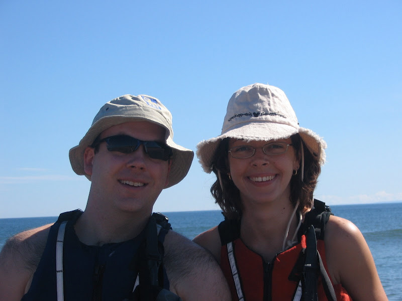
It was a beautiful spring day on Sunday with perfect conditions for a paddle. The sun was shining and there was hardly a cloud in the sky. The UV index was reasonable and the air temperature was around 16, even the water temperature was merely chilly, not frigid.
Shirley's Bay is on the Ottawa River and is a part of the NCC Park system. There is an excellent launching point for both powerboats and kayaks/canoes there. The park itself is quite nice with some walking trails nearby and a beautiful view of the River and Gatineau in the distance.
We have paddled this stretch once before, last year, and knew the route so it wasn't a trip to discover the wilderness, we just wanted to stretch our paddling muscles some!
We headed west along the Ontario bank of the river. There is a rifle range on the Ontario side (the road to the launch point is called Rifle Road) so you can hear random gunshots going off.
After you paddle for about 30 minutes you will come along a little island. Normally this is a great spot to pull up on the beach and have lunch as the island is small, surrounded by beach with real sand and right in the middle of the river. On this occasion though the water level was really high so there wasn't much beach, and what beach was there was covered by seagulls! Dozens of them. So we kept on paddling.
The only other event was coming across the set of buoys marking off the DND water. These were bright yellow, scattered everywhere and marked with big Danger! signs. Suffice it to say we left it at that.
So that was the first paddle of the season, not too exciting but a good stretch.
Tuesday, May 8, 2007

Sunday, March 11, 2007
A new GPS unit
After a couple of years of using my original Garmin eTrex Legend I finally decided to upgrade. After looking at the various models I decided on the top-of-the-line Garmin model, the GPSMap 76CSx.
My eTrex Legend had a lot of limitations. First off it used a serial port to connect to the computer, which was a bit of a drag. Serial ports are slow, don't provide power and most laptops don't have them anymore so you need an adapter to connect. Just the few maps of the Ottawa-Gatineau took 7 minutes to transfer. Secondly, the Legend only had 8MB of mapping memory. You could only fit a few maps into the unit, depending on the density of the maps. Another down point was the unit's inability to pick up a good signal in anything but perfect coverage. Deep foliage, buildings, etc. prevented it from picking up a signal.
Then along comes my GPSMap 76CSx. This puppy has expandable microSD card memory, a USB interface, a faster processor and an antenna that is unrivaled in its ability to pick up a signal. I bought a 1GB Kingston microSD memory card to hold a ton of maps and data. I also picked up Garmin's Topograhic Canada v4 map suite. This suite has excellent 1:50000 topo maps of all of Canada with trail markings, parks, and roads on it.
I haven't been able to try the unit out while hiking yet but I've had it out driving and already its superiority is evident. Where with my Legend I could only get a signal with the GPS on the dashboard, the GPSMap 76CSx gets a clear signal anywhere in the car. As well the driving direction functionality is vastly improved. The faster processing makes navigating through the map on the unit much quicker and easier. The color is a nice feature but not a 'must-have'. There are many nice extras like an electronic compass and a barometric altimeter. The sweetest thing for me is that the unit floats in water and can survive up to 30 minutes at 1 metre depth exposure. This makes it ideal for kayaking!
For anyone out there considering buying this product I would highly recommend it!
My eTrex Legend had a lot of limitations. First off it used a serial port to connect to the computer, which was a bit of a drag. Serial ports are slow, don't provide power and most laptops don't have them anymore so you need an adapter to connect. Just the few maps of the Ottawa-Gatineau took 7 minutes to transfer. Secondly, the Legend only had 8MB of mapping memory. You could only fit a few maps into the unit, depending on the density of the maps. Another down point was the unit's inability to pick up a good signal in anything but perfect coverage. Deep foliage, buildings, etc. prevented it from picking up a signal.
Then along comes my GPSMap 76CSx. This puppy has expandable microSD card memory, a USB interface, a faster processor and an antenna that is unrivaled in its ability to pick up a signal. I bought a 1GB Kingston microSD memory card to hold a ton of maps and data. I also picked up Garmin's Topograhic Canada v4 map suite. This suite has excellent 1:50000 topo maps of all of Canada with trail markings, parks, and roads on it.
I haven't been able to try the unit out while hiking yet but I've had it out driving and already its superiority is evident. Where with my Legend I could only get a signal with the GPS on the dashboard, the GPSMap 76CSx gets a clear signal anywhere in the car. As well the driving direction functionality is vastly improved. The faster processing makes navigating through the map on the unit much quicker and easier. The color is a nice feature but not a 'must-have'. There are many nice extras like an electronic compass and a barometric altimeter. The sweetest thing for me is that the unit floats in water and can survive up to 30 minutes at 1 metre depth exposure. This makes it ideal for kayaking!
For anyone out there considering buying this product I would highly recommend it!
Sunday, March 4, 2007
Snowshoeing - Carmen Trails
This was our first major (difficult) snowshoe of the season. The weather was nice, cloudy most of the day with the sun peeking out every now and again. The air temperature was about -3 and when in the woods the wind never hit us so we didn't have to worry about the wind chill.
Carmen Trails is listed as a black diamond trail which means its difficult, and they weren't kidding! We started off by taking the High Road (trail 58) first as we wanted to cruise into the finish. Also we had hiked this trail in the summer two years ago and knew that the High Road was indeed quite high. There was a lot of fresh snow from the storm at the end of the week and off the packed trail snow could be as much as two feet deep. It made for a lot of fun playing around in.
Since this trail is fairly busy (the parking lot was overflowing when we got there) there was no wildlife to be seen. The closest we got were some rabbit tracks in the snow. As for scenery there is some amazing views of the Gatineau Valley around Wakefield from the top of the High Road. Well worth the climb!
We hope to go back sometime soon and take the Carmen Trails (non-57,58) which go down and around Lac Carmen. It looked beautiful down there.
Pictures
Carmen Trails is listed as a black diamond trail which means its difficult, and they weren't kidding! We started off by taking the High Road (trail 58) first as we wanted to cruise into the finish. Also we had hiked this trail in the summer two years ago and knew that the High Road was indeed quite high. There was a lot of fresh snow from the storm at the end of the week and off the packed trail snow could be as much as two feet deep. It made for a lot of fun playing around in.
Since this trail is fairly busy (the parking lot was overflowing when we got there) there was no wildlife to be seen. The closest we got were some rabbit tracks in the snow. As for scenery there is some amazing views of the Gatineau Valley around Wakefield from the top of the High Road. Well worth the climb!
We hope to go back sometime soon and take the Carmen Trails (non-57,58) which go down and around Lac Carmen. It looked beautiful down there.
Pictures
Subscribe to:
Posts (Atom)